


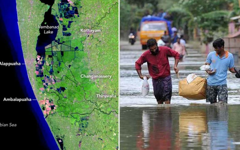
In the aftermath of the worst flood in over a century, Kerala is still left picking up the pieces as it tries to rehabilitate the ones in relief camps. While a portion of those affected by the floods returned to whatever was left of their homes, many others didn’t have anything to return to. Their entire life savings were washed away in a matter of weeks and the government and citizens alike are working day and night to restore Kerala back to its glory.
The CM of Kerala shared this update just a week after the red alert was lifted:
Updates on restoration works: 1,31,683 houses have been cleaned, which is 31% of the total flood-hit houses. Electricity has been restored for 23.36 lakh connections of the 25.6 lakh disrupted.14,314 transformers (out of 16158 affected) are now functioning. #KeralaFloodRelief
— CMO Kerala (@CMOKerala) August 25, 2018
And though an amazing number of people from all over the world have come forward to provide financial aid to the state, the truth is, considering the true extent of the devastation wrecked on Kerala it would take a lot more to get things back in order.
NASA recently released satellite images of Kerala before and after the floods and they will show you exactly how severe the floods were:
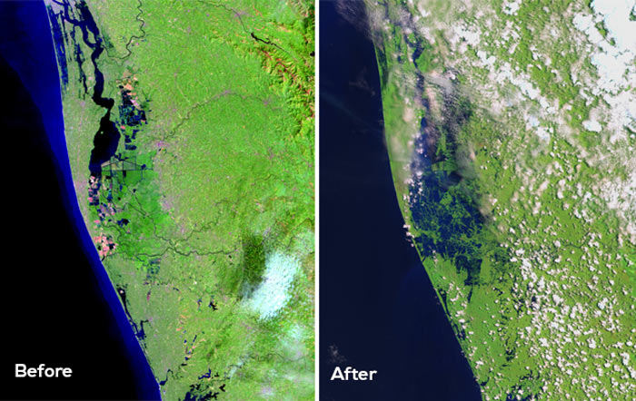
The first image which was taken on the 6th of February 2018, shows the lay of the land in its previous state with the water bodies well defined.

The second image was taken on the 22nd of August following the red alert being lifted and it tells a completely different story.

The final death toll between the rain-ravaged days of August 8th and August 26th has been tallied at 302 by the officials. The satellite images provided by NASA make you realise just how daunting a task is ahead for the people of Kerala.