


Although we had an unexpected and pleasant start of the summer season, one can now definitely feel the May-heat taking over and the mercury soaring. Well, that’s a clear indication that the country is soon to be gripped by the intense heatwave.

Several parts of northern India are already experiencing increasing discomfort due to the sudden rise in temperatures. Churu in Rajasthan was the hottest city in India on Tuesday with temperature touching the 50-degree mark. New Delhi was reportedly the second hottest city with a maximum temperature of 47.6 degree Celsius.
Heat Wave hits Delhi. Severe Heat Wave at Palam @Indiametdept @IMDWeather pic.twitter.com/uMSbLOzs8S
— RWFC New Delhi (@RWFC_ND) May 26, 2020
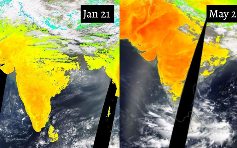
Well, according to these images shared by NASA, it looks like the ground beneath is burning up. Satellite images procured from NASA Worldview shows how the surface of the country looked yesterday. The hottest (or reddest) areas in the images showed a land temperature of around 50 degree Celsius, reports India Today.
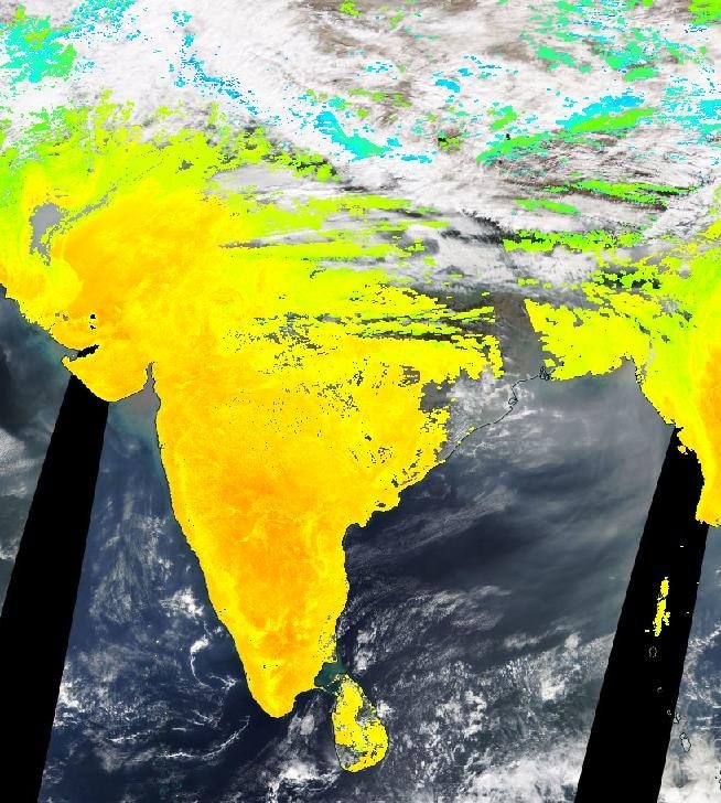
To let you gauge the changing temperature levels, here’s an image from January 21. Most of the image appears yellowish-green indicating that the temperature was relatively lower.
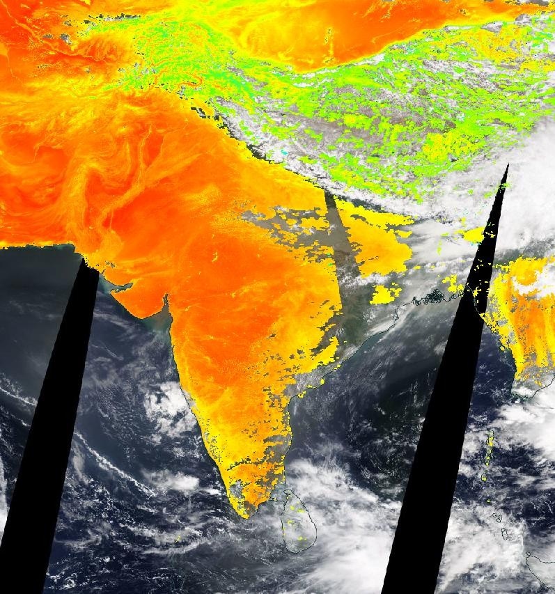
Here’s how hot the surface of the ground beneath your feet has been today. We can still see the impact of the Cyclone Amphan.
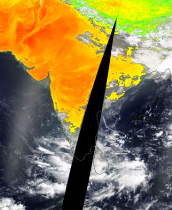
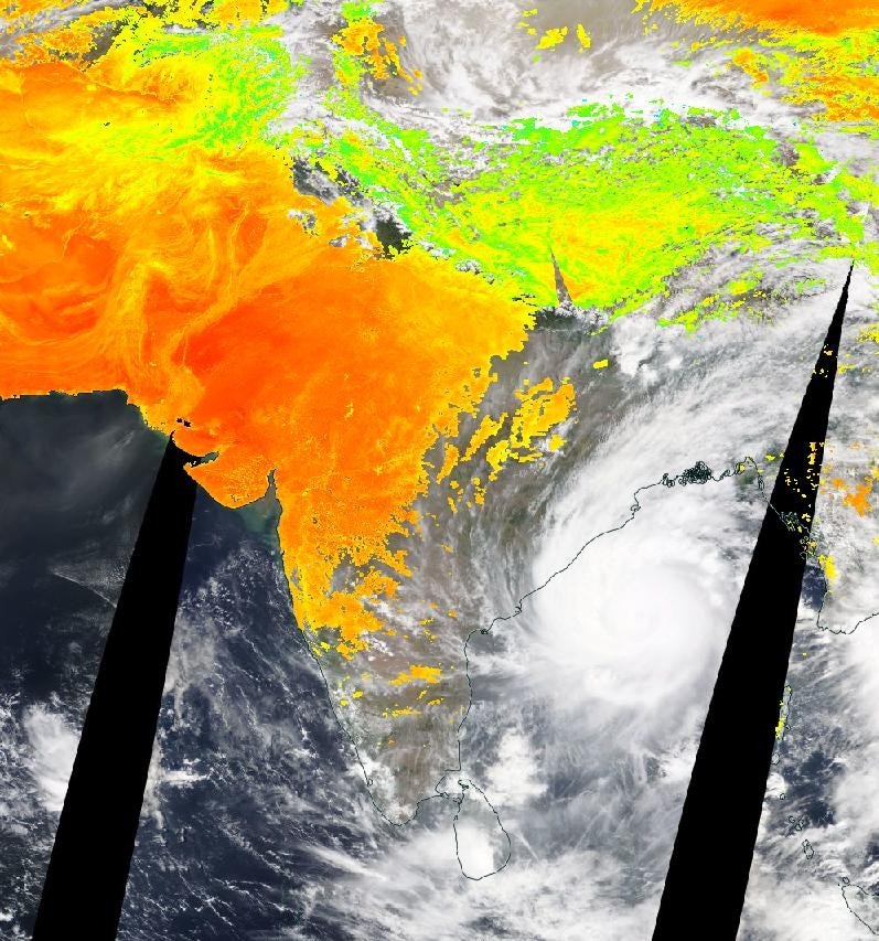
In this image, taken on May 19, one can see the Cyclone Amphan entering the country.
According to the portal, this feature gives the temperature of ‘whatever is on the surface of the Earth, like, bare sand in the desert, ice and snow-covered area, a leaf-covered tree canopy and even the temperature of man-made buildings and roads’.
Although the images are quite worrisome, the meteorological department said that Monsoon is likely to arrive in Rajasthan on June 25 and will continue till September 20. Let’s just hope for the best.